Niamey Square Degree mesoscale site - Niger
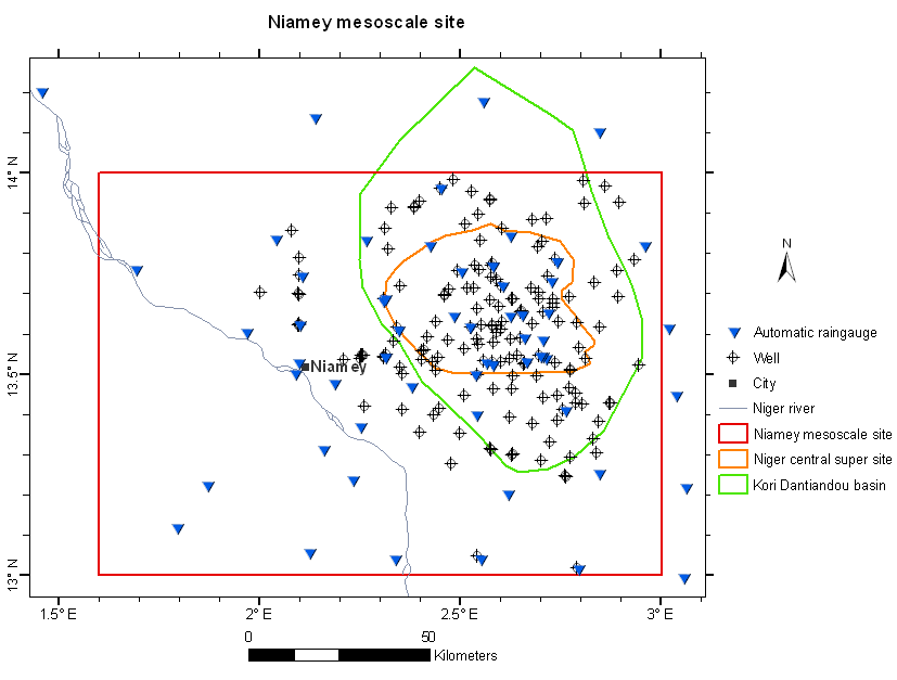
The Niamey Square Degree mesoscale site (Niger) is part of the mesoscale observation network of the AMMA-CATCH observatory. Various instruments monitor the water cycle and vegetation dynamics since the Hapex-Sahel experiment in 1990 (Goutorbe, Lebel et al., 1994). Their distribution is shown on the map below. An interactive map of the instrument at different scale is available on the AMMA-CATCH database portal.
Its characteristics are as follows :
[(The Mesoscale site of the square degree of Niamey (10,000 km²) has a Sahelian climate, with a rainy season of about 4 months (450-600 mm), the average annual temperature is 29°C. The population density (excluding the city of Niamey) is 30 inhabitants per km², and the main socio-economic activities are rain-fed crops (mainly millet) and pastoralism. The hydrological regime is endoreic on the left bank of the Niger River (sedimentary) and exoreic on the right bank (basement zone).
» Niger : Map of instruments set up on the Square Degree Mesosite
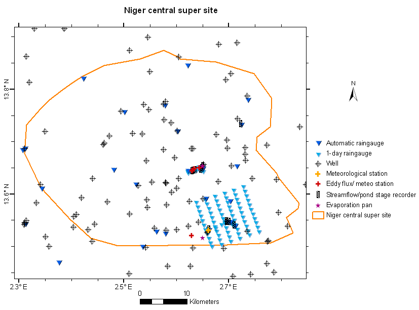
» Niger : Map of instruments set up on the Square Degree Mesosite/ Central supersite
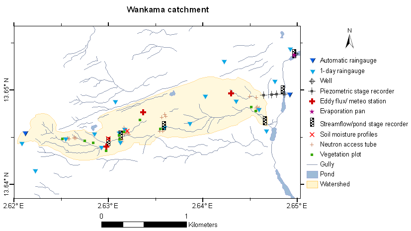
» Niger : Map of instruments set up on the Square Degree Mesosite/ Wankama Intensive Local Site
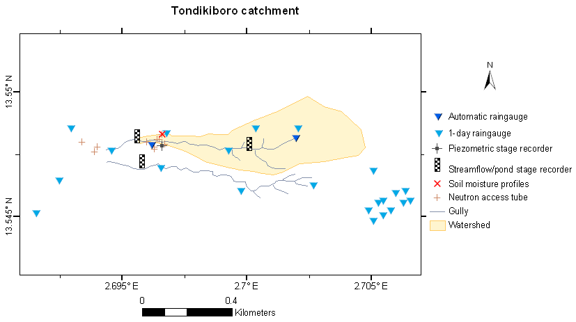
» Niger : Map of instruments set up on the Square Degree Mesosite/ Tondikiboro Intensive Local Site)])]
Niger mesosite : Map of the mesoscale site of the square degree of Niamey
Niger mesosite : Map of the Niger Central super site
Niger mesosite : Map of the Wankama Intensive site
Niger mesosite : Map of the Tondikiboro Intensive site
Updated on 26 janvier 2022


