Benin
Upper Oueme watershed mesoscale site
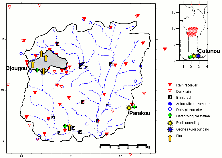
The Upper Oueme catchment (Benin) is part of the mesoscale observation network of the AMMA-CATCH observatory. Various instruments monitor the water cycle and vegetation dynamics since 1997. Their distribution is shown on the map below. An interactive map of the instrument at different scale is available on the AMMA-CATCH database portal.
Its characteristics are as follows :
[(The Upper Ouémé catchment (14,000 km²) has a Sudanese climate, with a 7-month rainy season (1200-1300 mm), intermittent rivers, and an average annual temperature of 25°C. The population density is 48 inhabitants per km². The main activities are rain-fed agriculture and livestock breeding. Wooded savannahs and open forests cover 60% of Haut Ouémé in 2013 (80% in 1975). Some of these natural areas are classified forests.
» Benin : Map of instruments set up on the Upper Oueme catchment
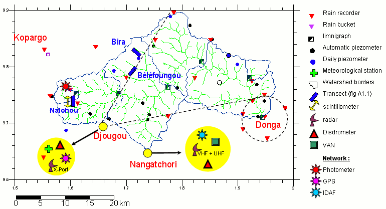
» Benin : Map of instruments set up on the Upper Oueme catchment/ Donga watershed supersite
» Benin : Map of instruments set up on the Upper Oueme catchment/ Nalohou Local Intensive site (cultivated area including crops and fallow)
» Benin : Map of instruments set up on the Upper Oueme catchment/ Béléfoungou Local Intensive site (woodland with Isoberlinia)].
Benin mesosite : Map of the mesoscale >Upper Oueme watershed
Benin mesosite : Map of the Donga Watersehed
The Donga basin covers 576 km². The super site comprises :