Mali
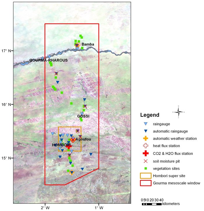
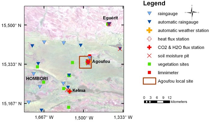
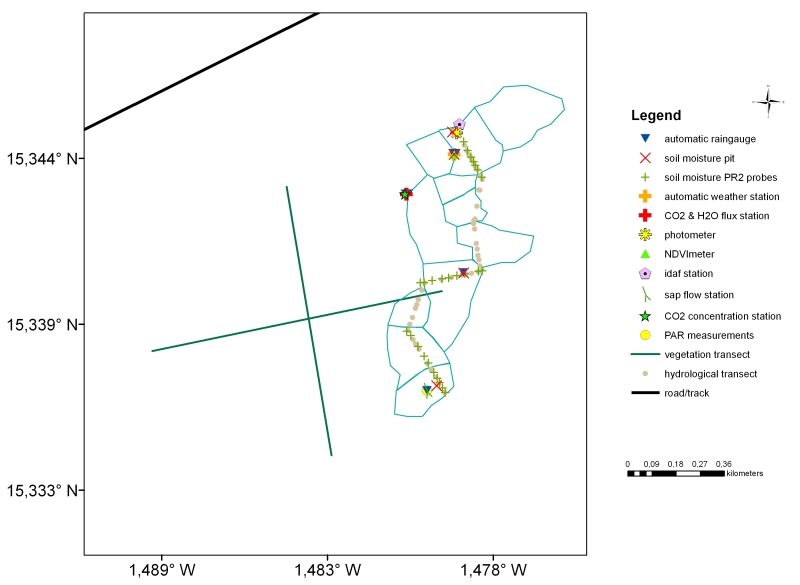
The Gourma mesoscale site (Mali) is part of the mesoscale observation network of the AMMA-CATCH observatory. Various instruments have been deployed there since 1984, in order to monitor the water cycle and vegetation dynamics. Their distribution is shown on the map below [observation period : 2004-2011]. An interactive map of the instruments at different scales is available on the AMMA-CATCH database portal.
Its characteristics are as follows :
[(The Gourma mesoscale site (30 000 km²) is subject to a Sahelian to North Sahelian climate, with a short rainy season of about 3 months (annual rainfall : 200-400 mm). The average annual temperature is 30.2°C in Hombori. The dominant vegetation formation is a shrubby savannah on sandy dunes that alternate with erosion surfaces with strong runoff that converge towards ponds (endoreism). The population density is low, less than 7 inhabitants per km², and the main socio-economic activity is pastoralism. Millet cultivation is only practiced in the southern part of the mesoscale site.
[*Since 2012 the monitoring of this site is on standby for security reasons*].
In 2021, only rainfall and vegetation measurements will continue in the vicinity of the town of Hombori, in what used to be the AMMA-CATCH super-site. The observations are conditional on the evolution of the security situation.
» Mali : Map of instruments set up on the Gourma mesosite (2004-2011)
» Mali : Map of instruments set up on the Gourma mesosite/ Hombori supersite (2004-2011)
» Mali : Map of instruments set up on the Gourma mesosite/ Agoufou Intensive site (2004-2011))]
Mali mesosite : Map of the Gourma mesosite (2004-2011)
[*Since 2012 the monitoring of this site is on standby for security reasons.*]
See below the instruments deployed (2004-2011 period) on the mesosite.

Mali mesosite : Map of the Hombori supersite (2004-2011)
[*Since 2012 the monitoring of this site is on standby for security reasons.*]
See below the instruments deployed (2004-2011 period) on the supersite.

Mali mesosite : Map of the Wankama Intensive site (2004-2011)
[*Since 2012 the monitoring of this site is on standby for security reasons.*]
See below the instruments deployed (2004-2011 period) on the intensive local site.


